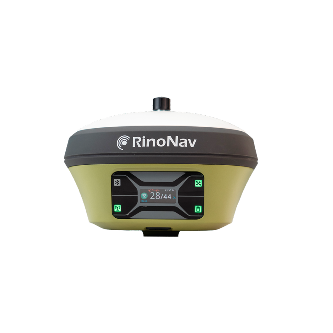
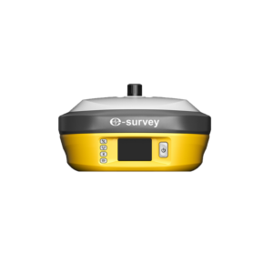
Rinonav Theia

The RinoNav THEIA combines 1408-channel GNSS tracking, a powerful 5W UHF radio, integrated 4G connectivity, multi-constellation support, and reliable RTK correction broadcasting, making it an excellent solution for surveyors, construction professionals, UAV operators, and geospatial organizations requiring dependable base station performance.

About the Rinonav Theia.

The RinoNav THEIA is a rugged GNSS base receiver engineered to provide reliable RTK correction data for surveying, mapping, construction, UAV, marine, and agricultural applications. Equipped with a powerful 5-watt internal UHF radio, integrated 4G modem, and advanced multi-constellation GNSS technology, THEIA delivers stable and accurate base station performance even in demanding field environments. It supports GPS, BeiDou, GLONASS, Galileo, and QZSS satellite systems with up to 1408 channels, ensuring dependable correction data transmission and exceptional positioning reliability.

Specifications

GNSS & Positioning

Feature / Specification Details
GPS L1 C/A, L2P (W), L5
BeiDou (BDS) B1I, B2I, B3I, B1C, B2a
GLONASS L1, L2
Galileo E1, E5a, E5b
QZSS L1, L2, L5
High Precision Static Horizontal: 2.5 mm + 0.5 ppm RMS
Vertical: 5 mm + 0.5 ppm RMS
Standard Point Positioning Horizontal: 1.5 m RMS
Vertical: 2.5 m RMS

Communication & Connectivity

Feature / Specification Details
Bluetooth Bluetooth 5.0 BR + EDR, BLE
Wi-Fi IEEE 802.11 b/g/n
Cellular Network LTE Cat4
LTE FDD Bands B1/B2/B3/B4/B5/B7/B8/B12/B13/B18/B19/B20/B25/B26/B28
LTE TDD Bands B38/B39/B40/B41
WCDMA B1/B2/B4/B5/B6/B8/B19
GSM 850 / 900 / 1800 / 1900 MHz
SIM Card Slot Yes
Web Interface Firmware Updates, Status Monitoring, Configuration & Data Download

Feature & Specification

Feature / Specification Details
GPS L1 C/A, L2P (W), L5
BeiDou (BDS) B1I, B2I, B3I, B1C, B2a
GLONASS L1, L2
Galileo E1, E5a, E5b
QZSS L1, L2, L5
High Precision Static Horizontal: 2.5 mm + 0.5 ppm RMS
Vertical: 5 mm + 0.5 ppm RMS
Standard Point Positioning Horizontal: 1.5 m RMS
Vertical: 2.5 m RMS

Backed by GeoSurv Africa

Calibration, repair and accuracy testing for most professional brands.

We match the kit to your accuracy needs and budget, no upselling.

Phone, email or WhatsApp a person who actually knows the gear.

Cover project peaks or service downtime with short-term hire.

How is THEIA managed and monitored?

The receiver supports web-based management, remote monitoring, and configuration tools for efficient base station control.

Is THEIA a base station or rover receiver?

THEIA is primarily designed as a high-performance GNSS base station for transmitting RTK corrections to rover receivers.

How many GNSS channels does THEIA support?

THEIA supports up to 1408 GNSS channels, enabling robust multi-constellation satellite tracking.

Which satellite constellations are supported?

The receiver tracks GPS, GLONASS, Galileo, BeiDou, QZSS, and SBAS satellites for maximum positioning reliability.

Does THEIA include an internal UHF radio?

Yes. It features a powerful 5W internal UHF radio for long-range RTK correction transmission.

Trusted by Professionals

The quality of the equipment and level of service exceeded our expectations. GeoSurv Africa has become our preferred surveying solutions provider.

Sipho DlaminiSenior Surveyor

GeoSurv Africa has been instrumental in helping us deliver projects accurately and on schedule. Their equipment is reliable, and their support team is always ready to assist.

Pieter Botha,Project Manager

GeoSurv Africa's commitment to quality and customer satisfaction sets them apart. Their knowledgeable team always provides practical solutions tailored to our needs.

Andrew SmithLand Surveying Professional

The training and technical support we received were invaluable. The team ensured we were confident using the equipment and achieving accurate measurements from day one.

James PetersonEngineering Survey Specialist

Reliable products, expert advice, and excellent service. GeoSurv Africa continues to play an important role in helping us deliver successful projects on time and within budget.

Thabo MokoenaDavid Nkosi, Land Surveyor

GeoSurv Africa consistently provides reliable surveying equipment and exceptional support. Their team helped us select the right solution for our project, and the results exceeded our expectations.

Richard BothaInfrastructure Project Coordinator

They helped us choose the right equipment based on our actual project needs. Honest advice, quality products, and excellent after-sales support.

Ryan JacobsCivil Contractor, Durban, Durban

Related Products

Products

Browse by Industry & Category