
The quality of the equipment and level of service exceeded our expectations. GeoSurv Africa has become our preferred surveying solutions provider.
Sipho DlaminiSenior Surveyor
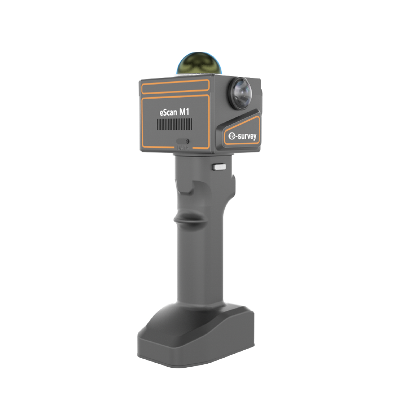
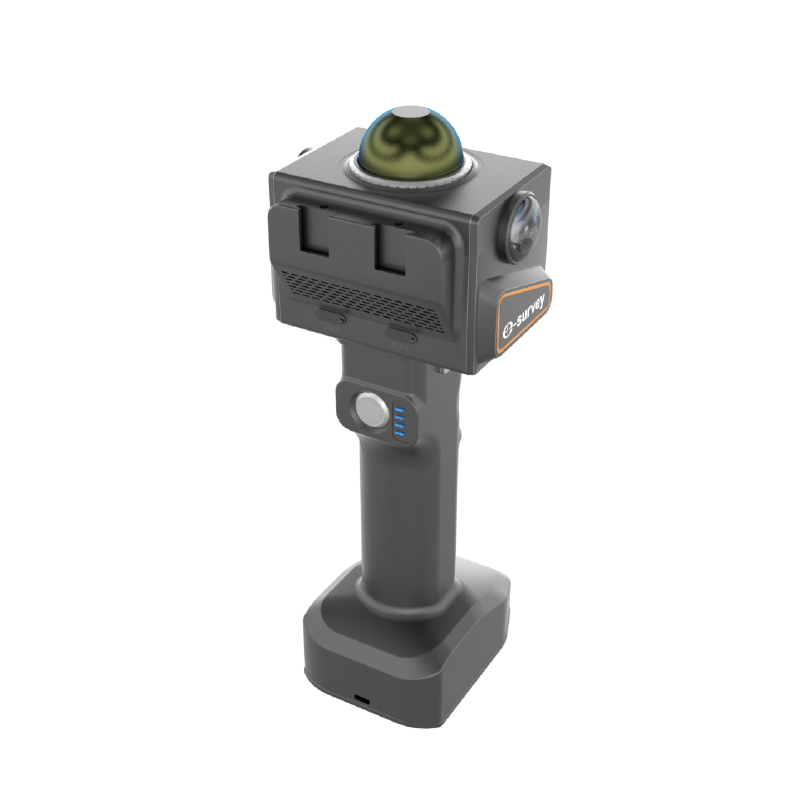
EScan M1 is a compact handheld LiDAR scanner featuring real-time 3D mapping, dual-camera color point clouds, and centimeter-level accuracy, providing fast and efficient data collection for surveying and mapping professionals.
E-Survey eScan M1 is a lightweight handheld LiDAR scanner that combines 3D point cloud scanning, real-time color mapping, and SLAM technology in a compact device. Weighing just 560 g, it delivers fast, accurate, and efficient 3D data capture for surveying, construction, mining, forestry, architecture, and infrastructure applications. It supports real-time point cloud generation, dual 5 MP cameras, and up to 70 m scanning range.

| Laser Specification | Details |
|---|---|
| Range | 0.1–70 m |
| Points per Second | 200,000 |
| Field of View | 360° × 59° |
| LiDAR Channels | 40 |
| Laser Wavelength | 905 nm |
| Laser Class | Class 1 (IEC60825-1:2014) |
| Performance Specification | Details |
|---|---|
| Relative Accuracy | 2 cm |
| Absolute Accuracy | 3 cm |
| Point Cloud Thickness | 1 cm (Unfiltered) |
| Trajectory & Mapping | Real-time SLAM mapping powered by eScan |
| Registration | Real-time, no post processing required |
| Camera | Dual 5 MP Fisheye, Global Shutter |
| General Specification | Details |
|---|---|
| RTK Module | Supported |
| Dimensions | 116 × 122 × 286 mm |
| Weight | 0.56 kg, or 1 kg including battery |
| Operating Temperature | -20°C to +50°C |
| Battery Capacity | 5000 mAh |
| Battery Duration | 1.5 hours |
| Internal Storage | 512 GB SSD |
| Data Transfer | USB 3.0 |
| Connection Mode | WiFi (802.11 b/g/n) |
| IP Rate | IP54 |
| Environment | Indoor and Outdoor |
| Manufacturer Warranty | 1 Year (6 months for battery) |
| Data Processing Specification | Details |
|---|---|
| Operation | One Touch Start and Stop |
| Data | Color Point Clouds with Intensity, 360° Images, Trajectory |
| Smartphone Operation | Live Scan App: scanner control, real-time data registration and direct synchronization with cloud server |
| Desktop Processing | PrecisionHub software for Windows |
| Modeling and Roaming | Gaussian Splatting Modeling Software |
| Output | E57, LAS, LAZ, PCD, XYZ, BIN |
Calibration, repair and accuracy testing for most professional brands.
We match the kit to your accuracy needs and budget, no upselling.
Phone, email or WhatsApp a person who actually knows the gear.
Cover project peaks or service downtime with short-term hire.
The eScan M1 is a handheld LiDAR scanner designed for fast and accurate 3D mapping, surveying, and data collection.
It is ideal for surveying, construction, mining, forestry, architecture, infrastructure inspection, and digital twin projects.
Yes, it uses SLAM technology to generate real-time point cloud data during scanning.
The scanner offers a maximum scanning range of up to 70 meters, depending on environmental conditions.
Yes, its lightweight design makes it comfortable for extended field use and easy transportation.
The quality of the equipment and level of service exceeded our expectations. GeoSurv Africa has become our preferred surveying solutions provider.
GeoSurv Africa has been instrumental in helping us deliver projects accurately and on schedule. Their equipment is reliable, and their support team is always ready to assist.
GeoSurv Africa's commitment to quality and customer satisfaction sets them apart. Their knowledgeable team always provides practical solutions tailored to our needs.
The training and technical support we received were invaluable. The team ensured we were confident using the equipment and achieving accurate measurements from day one.
Reliable products, expert advice, and excellent service. GeoSurv Africa continues to play an important role in helping us deliver successful projects on time and within budget.
GeoSurv Africa consistently provides reliable surveying equipment and exceptional support. Their team helped us select the right solution for our project, and the results exceeded our expectations.
They helped us choose the right equipment based on our actual project needs. Honest advice, quality products, and excellent after-sales support.
Tell us what you need and we’ll get back to you within 1 business day.
